The second edition of a display on Subcontinental maps focuses on the nitty-gritty of survey charts and related histories

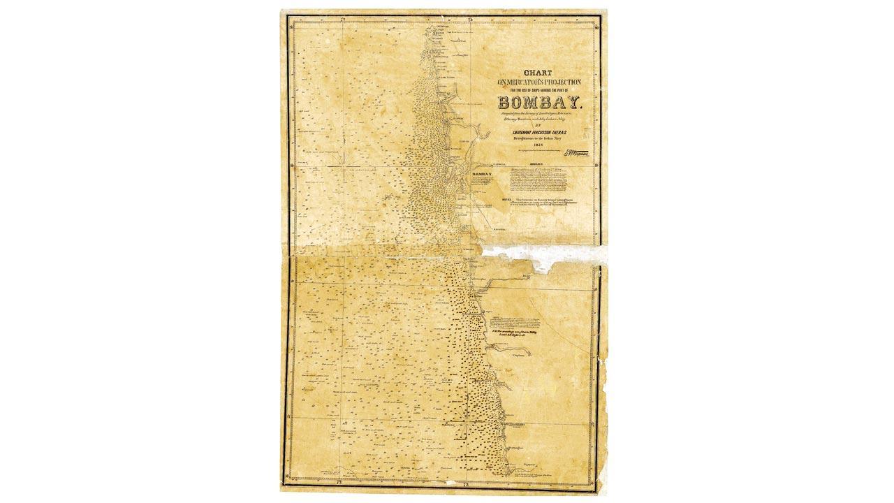
The Bombay mercator map, 1852. Pic Courtesy/Past Perfect
This writer is intrigued by big and wide lands, mighty mountains and unfathomable oceans being shrunk and fit onto a piece of paper. Maps make us feel as if we can hold a sizable chunk of the world in our palms. And the sheer variety of maps — ranging from the ones that narrate tales of conquest and capture to the ones on espionage, power play, revenue and more — make them a passionate pursuit. An upcoming one-month-long exhibition titled Mapped! — Surveys that left behind a legacy, will introduce viewers to a multitude of maps that not only elaborate on the journey of cartography, as a field of inquiry, but also reference periods in history.
ADVERTISEMENT
The exhibition is being organised by The Urban Heritage Committee of the Rotary Club of Bombay and The Asiatic Society of Mumbai. It has been curated by Past Perfect, a heritage management platform. About the display, Dr Shehernaz Nalwalla, vice-president of the Society, shares, “Last year, we shone a light on conservation processes. This year, we are focusing on survey maps. We are probing the earliest mappings of the Indian Subcontinent. The activity was first started by William Lambton and was later taken up by his assistant George Everest.” Some surveys could not have been conducted by the Britishers as the locals became hostile in their presence. So they had to train Indians who were called Pundits. “Pundits would often disguise themselves as monks or travellers to get into places and study them. These instances stand out as examples of positive British-Indian enterprise,” Nalwalla notes.
 Deepti Anand; Dr Shehernaz Nalwalla
Deepti Anand, co-founder, Past Perfect Heritage Management tells us that the curatorial journey has been filled with discussions as they had a large collection to choose from. “We wanted to select maps that could serve as devices for storytelling. We first dipped into each map visually and then proceeded to break them down and tie them with the reports that talk about the surveys. That brought the whole exercise alive for us.” Anand hopes for each visitor to go from map to map and get a sense of the different aspects of the Great Trigonometrical Survey (GTS), and the observations that branched out as an extension of it.
Ask her about the maps that deserve our special attention and she says, “While maps of Cape Comorin, Mysore, Uttar Pradesh, Bihar and the West Coast help people visualise the scale and expanse of GTS, one of the maps also goes into deconstructing the method. It shows a triangulation of the Northern Presidency of Bombay, which gives you a sense of how they would have actually gone about it.”
ON May 5 to June 4; 10.30 am to 6.30 pm; all days
AT Durbar Hall, The Asiatic Society of Mumbai, Fort.
LOG ON TO @asiatic-societymumbai
FREE
 Subscribe today by clicking the link and stay updated with the latest news!" Click here!


